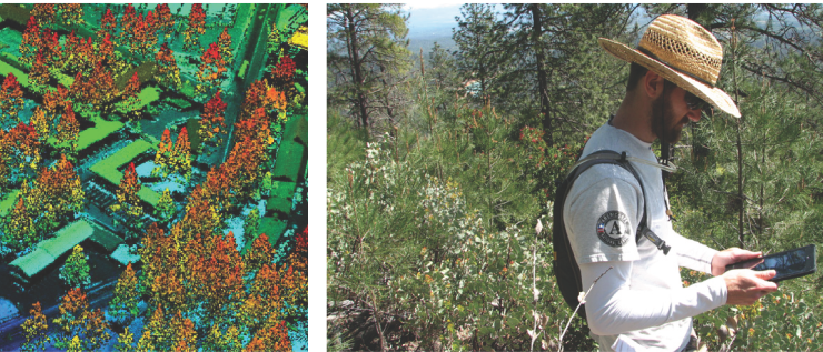
The Associate of Science degree in Geographic Information Systems (GIS) provides students with skills, knowledge and experience in the application of GIS. Students complete courses in the technical aspects of GIS and information technologies, along with courses in fields to which GIS is commonly applied, including geography, earth and social sciences, natural resources and engineering. Students gain knowledge of maps, geographic data, and imagery, while developing skills in data collection, analysis and map creation. As students progress through the program the applied field courses provide direction for learning about the application of GIS, which gives direction to GIS project work. Worksite learning allows students to gain GIS workplace experience in their chosen field and to develop contacts among the community of GIS professionals. Successful students will have strong computer and critical thinking skills. Refer to http://www.shastacollege.edu/gis for more information.
This degree is approved through the California Community College Chancellor’s Office. Upon satisfactory completion of all degree requirements and filing an application for graduation with Admissions and Records, the student’s transcript will reflect completion of this degree.
Program Outcomes:
Explain and summarize key GIS concepts, applications and societal implications. Perform GIS data acquisition, capture, editing, and attributing.
Manage GIS data through file management, database design, georeferencing and conversion.
Perform GIS analysis using queries, overlay functions, and models.
Produces maps on geographic themes that demonstrate effective communication, design aesthetics, application of GIS tools and use of cartographic standards.
Effectively engages with community through projects, volunteer activities, user meetings and worksite learning.
Demonstrates effective written and oral communication of GIS challenges and opportunities pertaining to application discipline.
Choose your path
Map your education by viewing the program map for the degree or certificate you’re interested in earning below. Meet with a counselor to create your official comprehensive education plan.
A program map shows all the required and recommended courses you need to graduate and a suggested order in which you should take them. The suggested sequence of courses is based on enrollment and includes all major and general education courses required for the degree.
Advisory: Essay-writing skills and eligibility to enroll in a transfer-level English Composition course or English Placement Level 6 or higher.
Digital Geographies explores how space, place, and representation are produced, contested, and mediated in the digital age, including changes to the behavior of individuals and groups. Governance, commerce, and culture have changed the perception of, and interaction with, geographic space. Geographic theories and geospatial methods are employed in the investigation and analysis of spatial aspects of society and human behavior. As government and industry have increasingly adopted surveillance technologies, new power dynamics and disparities have resulted across different geographic scales. Critical cartography serves as a framework for understanding power imbalances through time and space, while participatory GIS is presented as a means of empowering marginalized populations. The analysis of case studies reinforces how digital geographies are impacting individuals and society. This course may be offered in a distance education format.
This course is an introduction to maps, imagery, and geospatial technologies. Students will learn geographic techniques for data collection, interpretation, and presentation. Map principles along with types of maps and their applications are covered. Methodologies include map reading, use of imagery, geographic information systems (GIS), global positioning systems (GPS), and map creation. Recent trends such as crowd-mapping, drone image capture and Lidar are also investigated. This course may be offered in a distance education format.
Advisory: A grade of C or higher in CIS 1 or demonstrated computer literacy.
This course covers the theory and practice of geographic information systems (GIS). Students learn essential GIS procedures for data viewing, acquisition, manipulation, geographic referencing, and map creation. GIS data types, properties, database operations and applications are covered. Basic methods of GIS analysis are also included. This course focuses on the ArcGIS software platform, employing both desktop and online products. This course may be offered in a distance education format.
This course investigates Earth's physical systems, their dynamic processes, and surface expressions. Topics include weather, climate, hydrology, tectonics, geomorphology, and the biosphere. Attention is given to spatial patterns and impacts of human activities. This course may be offered in a distance education format.
This course investigates Earth's physical systems, through lab and field activities. Students will use maps, take measurements, and interpret physical phenomena in the lab. Students will observe, measure, and document landforms, hydrologic processes and ecosystems in the field. Data is gathered, displayed and interpreted from a range of sources. This course may be offered in a distance education format.
Note: This course requires a multi-day field trip.
Field studies of physical processes and formations are essential to the study of geography. Landforms, water resources, erosion hazards, soil conditions, and vegetation patterns are among the topics that illustrate the interactions between humans and the environment. Students will be exposed to a range of field techniques including observation, map use and measurement. The lecture portion of this course may be offered in a distance education format.
Advisory: Essay-writing skills and eligibility to enroll in a transfer-level English Composition course or English Placement Level 6 or higher.
This course will introduce students to the world's major geographic regions, increasing awareness and highlighting the significance of unifying geographic concepts by exploring the interrelation of physical, cultural, economic, and political characteristics. Key geographic features such as mountain ranges, rivers, countries, and major cities will also be an important part of the course. This course may be offered in a distance education format.
This course covers the design and implementation of geographic databases for GIS data capture and management. Included are essential concepts and practices of relational database management systems, with specific applications to GIS. Data is captured using GPS and mobile GIS methods. GIS digitizing and editing are also covered. This course may be offered in a distance education format.
This course is designed as an introduction to computer programming and technology for those students planning on a career in the field of computer science or related disciplines. The students will design, code, debug, and test programs in languages such as Machine, Assembler, Java, C++, Visual Basic and/or Python as determined by the Shasta College CIS committee. Common business applications are used to examine a wide range of methods for processing data in the interactive mode. Computer history, hardware, software, processing, systems, programming languages, storage devices, careers, and impact on society will be explored to enable the student to become literate in the technical aspects of computing. This course may be offered in a distance education format.
Note: This course requires a multi-day field trip.
Field studies of built landscapes and cultural expressions are essential to the study of human geography. Topics including land-use, planning, economy, transportation, social conditions, cultural practices and historical legacies will be explored. Students will be exposed to field techniques including note taking, interviews and map use. The lecture portion of this course may be offered in a distance education format.
This course is designed to provide individuals with a complete introduction to database concepts and the relational database model using Structured Query Language. Topics include normalization, design methodology, database administration, SQL commands, SQL functions and procedures. At the completion of this course, students should be able to understand a user's database requirements and translate those requirements into a valid database design using SQL. The MySQL and the Microsoft Access versions of SQL are utilized in the class exercises and projects. This course may be offered in a distance education format.
This course covers GIS for investigating geographic patterns, relationships and connections. Spatial analysis methods are employed for both raster and vector data. Emphasis is on problem-solving and decision making using GIS. Models and scripts for automating GIS processes also undertaken. This course may be offered in a distance education format.
This course covers fundamental concepts of cartography and visualization using geographic information systems (GIS). Students employ design principles to create effective maps, incorporating data from a variety of formats. Hardcopy and web maps are produced. Animations, 3D maps, and other visualization techniques are explored. This course may be offered in a distance education format.
This course covers remote sensing fundamentals as they apply to mapping of Earth's surface and features. Electromagnetic radiation of both visible and non-visible light is the foundation for image enhancement, classification and quantitative techniques. These techniques will be applied to imagery, of differing resolution, from a variety of sources. Particular attention is given to visual display imagery and with the integration of imagery with GIS datasets. Light Detecting and Ranging (LiDaR) is processed for elevation and land cover. This course may be offered in a distance education format.
Limitation on Enrollment: FINANCIAL AID STUDENTS: Students must maintain concurrent enrollment in seven (7) units which include work experience education units. Students not receiving financial aid do not need to enroll in other courses in order to participate in Work Experience Education.
The Geographic Information Systems(GIS) Work Experience Education course allows the student to gain on-the-job experience through employment/volunteerism at an approved GIS job site that is acquired by the student and related to the student's major. A faculty member supervises all WEE courses to ensure that the work experience is of educational value. The course stresses good work habits and meeting of competencies through actual on-the-job performance. A student may repeat this course since course content varies and skills are enhanced by supervised repetition and practice. A maximum of 14 units may be earned in a single semester.
Please see a counselor to discuss options for meeting general education requirements for transfer to California State Universities (CSU) and/or University of California (UC) campuses, as well as any specific additional courses that may be required by your chosen institution of transfer.
*Alternative Courses: Please see a Shasta College counselor for alternative course options. You can also view the following to find other courses to meet degree/certificate requirements: